 | YOSEMITE NATIONAL PARK IN VINTAGE BOOKLETS, BROCHURES, AND PAMPHLETS |
Here are some vintage booklets, brochures and pamphlets about Yosemite National Park.
| Introduction | Postcards - 1900-10s | Postcards - 1920s | Postcards - 1930s | Postcards - 1940s | Postcards - 1950s | Postcards - 1960s-90s | Booklets & Pamphlets | Books | Match Covers | Photographs | Postal History | Souvenir Folders | Souvenirs | Stereocards | View-Master Reels |
![]() Click on the thumbnail image for a larger view of the page.
Click on the thumbnail image for a larger view of the page.
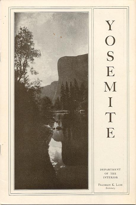 |  | 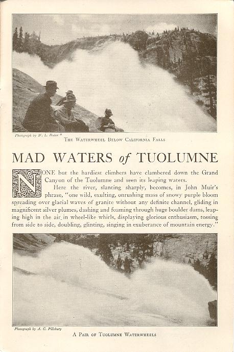 |
The booklet is titled "Yosemite" and has 24 pages with 28 photos. It is from a book or folder titled National Parks Portfolio published in 1916 by the Department of the Interior and printed by Charles Scribner's Sons, New York. The portfolio consists of nine separetely bound booklets and an introduction and contents held together in a cardboard folder.
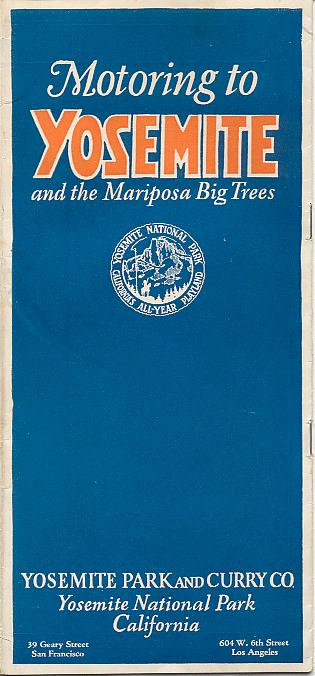 | 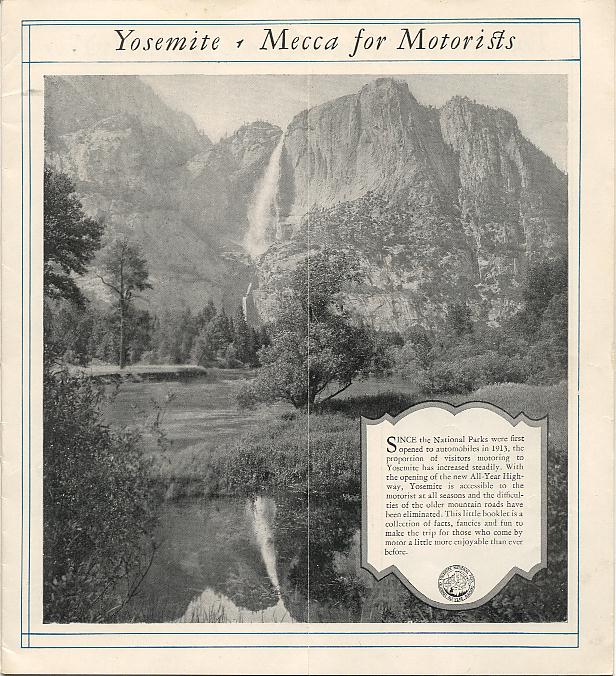 | 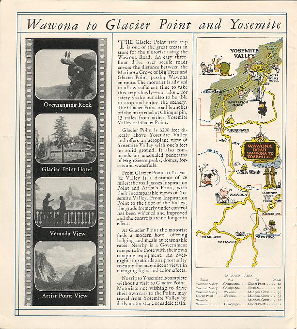 |
The folded booklet is titled Motoring to Yosemite and the Mariposa Big Trees and has 16 pages, 7 color maps, and one large and numerous small photos. It was published by Yosemite Park and Curry Co., Yosemite National Park, California, and printed by H. S. Crocker Co., San Francisco. No publication date is given; however, since none of the maps show state or U. S. highway numbers, it was probably published in the early 1920s.
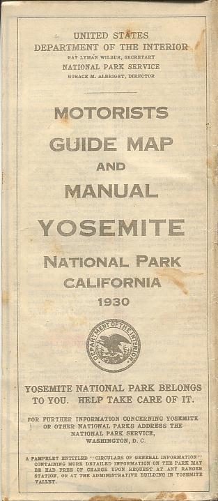 |  | 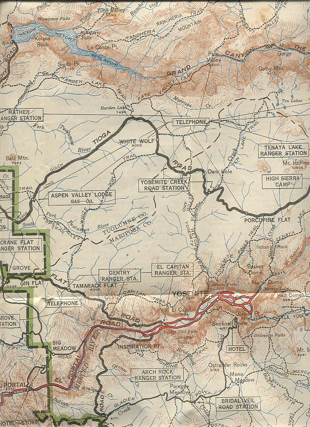 |
The folded pamphlet is titled Motorists Guide Map and Manual, Yosemite National Park, California and is a large folded color map with informational text on the back; unfolded it measures 32 1/2 x 28 1/2 inches. It was published in 1930 by the National Park Service. The map scan shows only a small portion of the complete map. This was probably the pamphlet given to visitors when they entered the park.
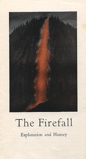 | 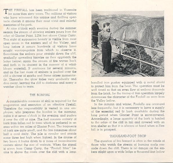 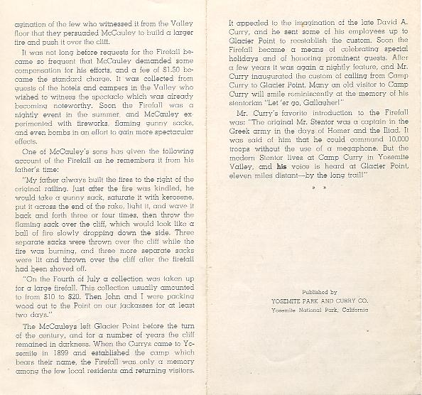 |
The small folded brochure is titled The Firefall Explanation and History. It was published by the Yosemite Park and Curry Co., Yosemite National Park, California. A publication date is not given; however, an analysis of the text suggests it was published circa 1932.
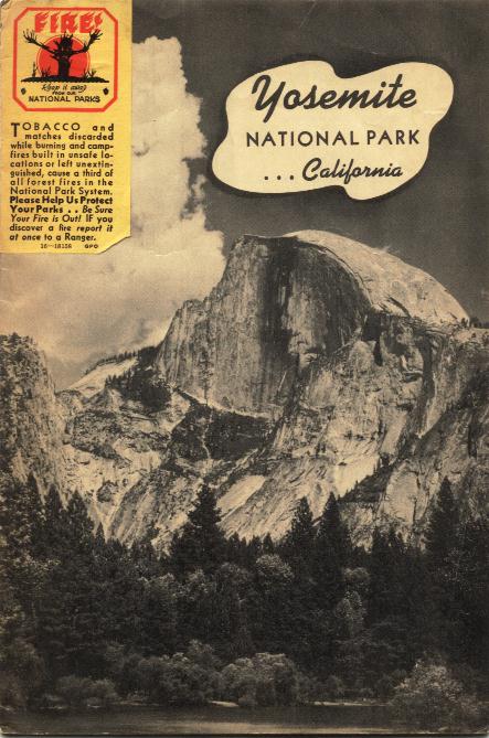 | 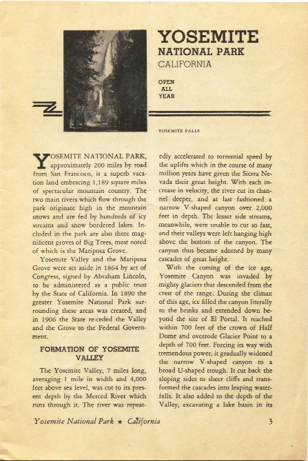 | 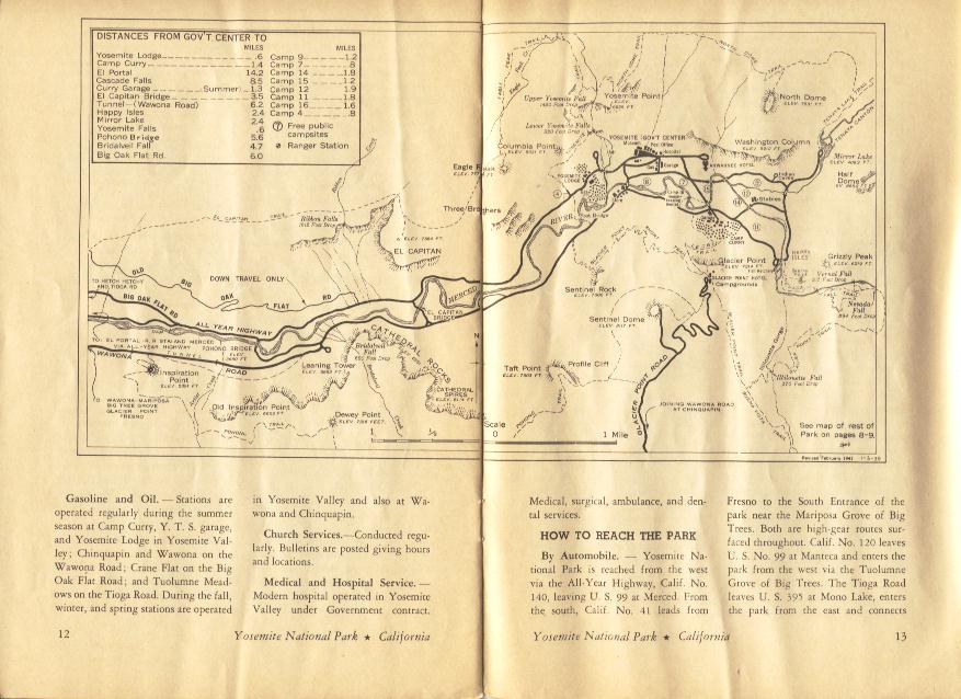 |
This pamphlet is titled Yosemite National Park ... California and has 16 pages, 2 maps, and one full page size photo and one small photo. It was published in 1941 by the National Park Service. Each of the maps covers two pages. The yellow sticker on the cover warns visitors to be careful with tobacco and matches and help prevent forest fires. This was the pamphlet given to visitors when they entered the park.
 | 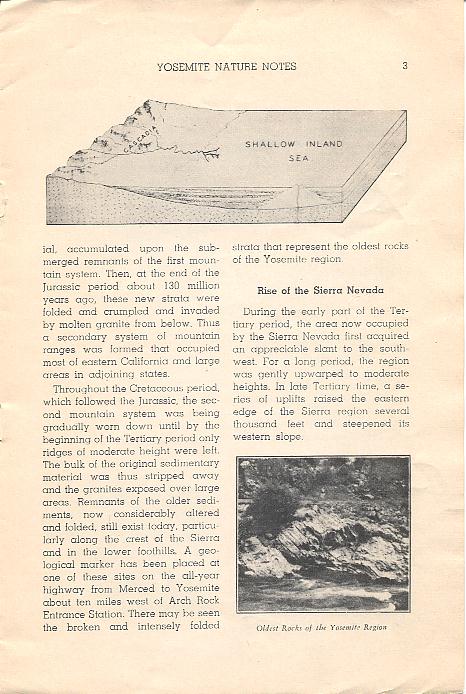 | 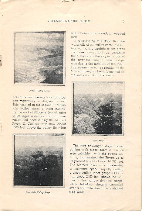 |
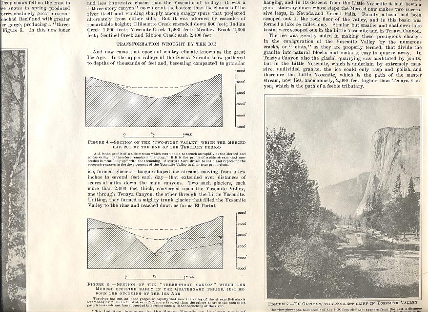
The pamphlet is titled A Brief Story of the Geology of Yosemite Valley and has 8 pages and 10 photos. The author is M. E. Beatty. It was published in 1943 (and reprinted in 1948) by the Yosemite Naturalist Department and the Yosemite Natural History Association.
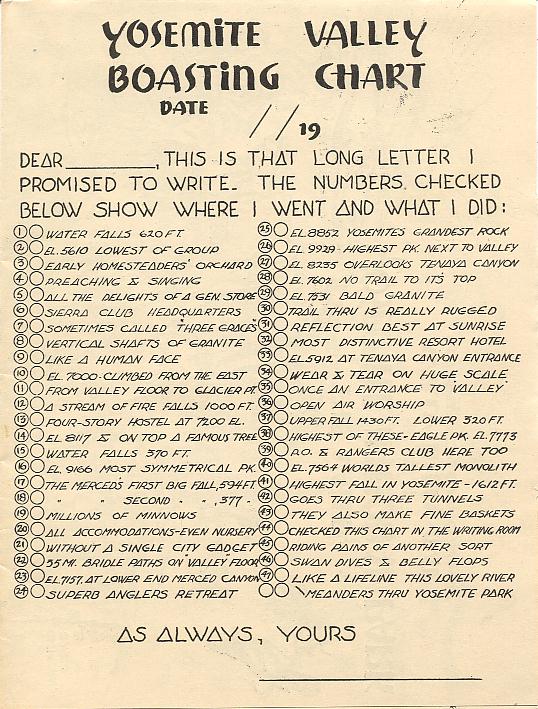 | 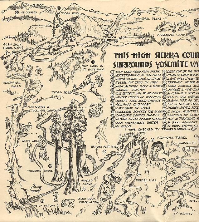 | 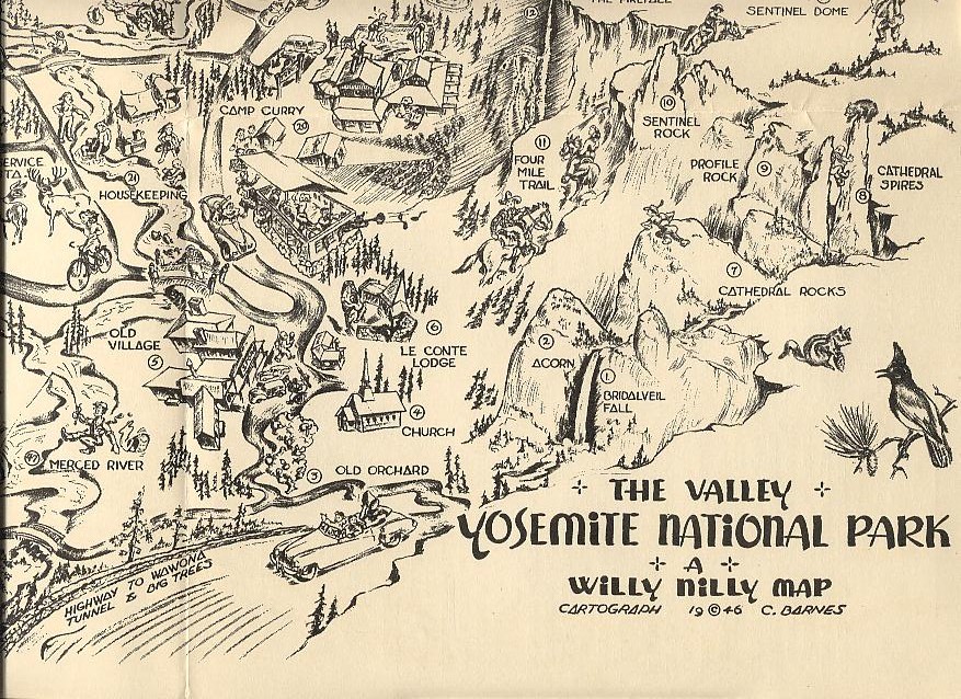 |
The large folded pamphlet is titled Yosemite Valley Boasting Chart and has a large folded map on one side and a smaller map and some text on the other side; unfolded it measures 19 x 14 1/8 inches. It was published in 1946. The publisher is not given; however, the map is by C. Barnes. The map scans show only a portion of the complete maps.
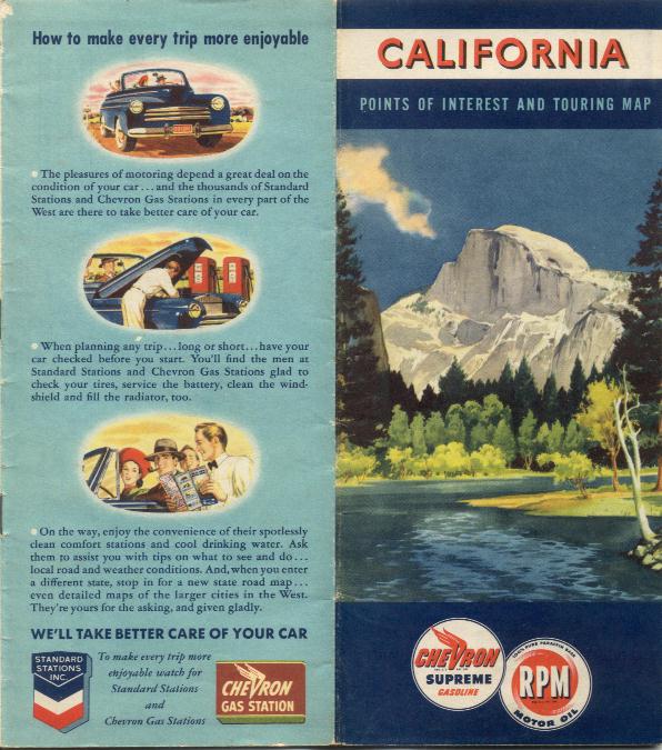 | 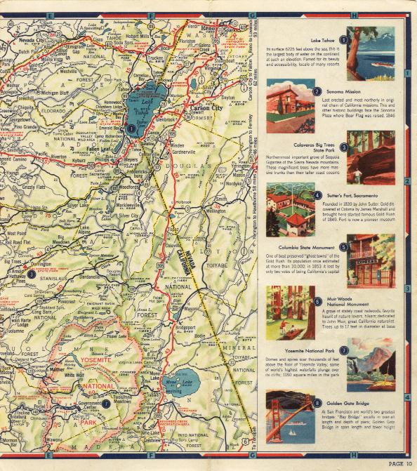 |
This folded map booklet is titled California: Points of Interest and Touring Map and has 19 pages, including an index and mileage chart. It was published in 1949 by the Standard Oil Co. of California, and printed by the H. M. Gousha Co., Chicago and San Jose. The cover (on the left) shows a view of Half Dome in Yosemite Valley. The scan on the right is of the map page that has Yosemite NP. Notice that point of interest #7 in the column on the right is Yosemite NP.
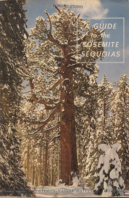 | 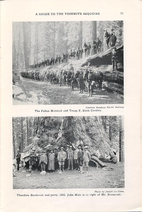 | 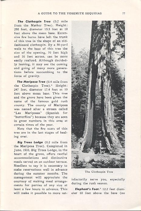 |
The booklet is titled A Guide to the Giant Sequoias of Yosemite National Park and has a color paper cover, 91 pages, 4 maps, and 22 photos (some full page size and some smaller). The author is James W. McFarland. It was published in 1949 by the Yosemite Naturalist Division and the Yosemite Natural History Association.
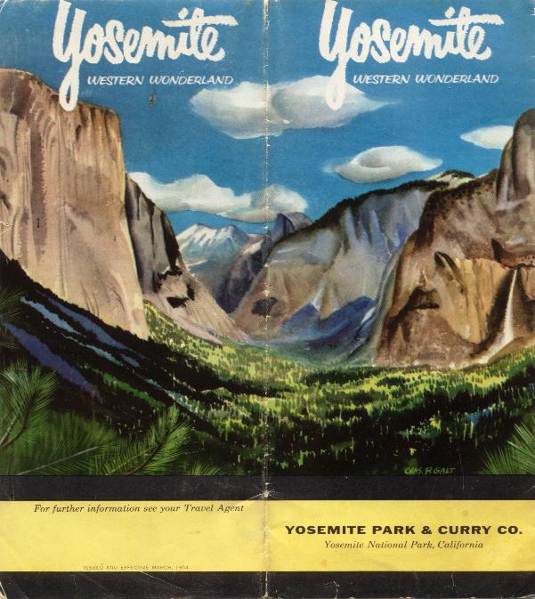 | 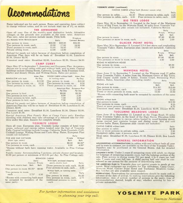 | 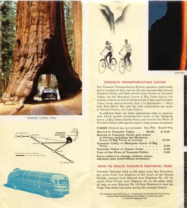 |
This folded advertising brochure is titled Yosemite: Western Wonderland and is a large folded sheet with text and photos on both sides. Unfolded it measures 16 x 18 inches; and it folds into 16 panels or pages. It was published in 1954 by the Yosemite Park & Curry Co. Each scan shows two of the panels.
 | 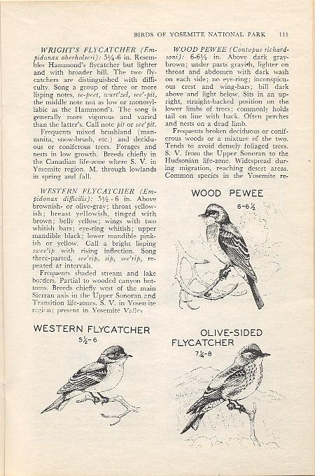 |  |
This booklet is titled Birds of Yosemite National Park, authored by Cyril A. Stebbins and Robert C. Stebbins. It has a color paper cover, 152 pages, numerous black & white drawings of birds, an identification, and an idex. It was published in 1954 by the Yosemite Naturalist Division and the Yosemite Natural History Association.
 |  | 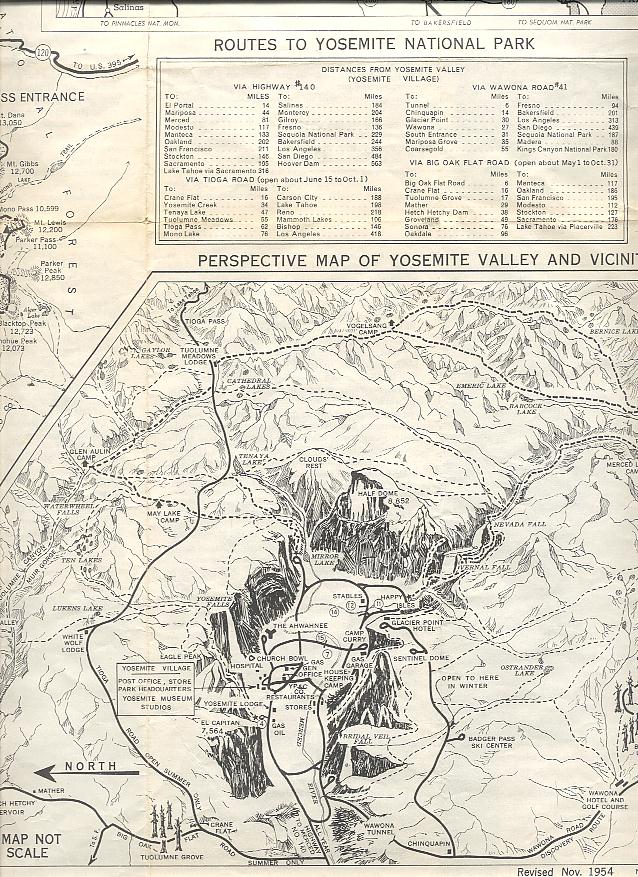 |
The folded pamphlet is titled Yosemite National Park, California and is a large folded sheet with three maps on one side and informational text on the back; unfolded it measures 23 1/8 x 18 1/2 inches. It was published in 1956 by the National Park Service. The map scan shows only a small portion of the map side. This was the pamphlet given to visitors when they entered the park.
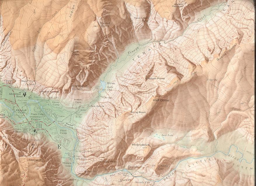 |  |
This is a color shaded relief topographic map on a large sheet and titled Map of Yosemite Valley, Yosemite National Park, California, Mariposa County; it measures 42 3/8 x 19 inches. It was published in 1958 by the U. S. Geological Survey. The map scan shows only a small portion of the map side. On the back is an illustrated article titled "The Story of the Yosemite Valley", by F. E. Matthes. The scan shows only a small portion of the article.
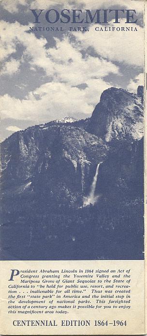 |  |  |
The folded pamphlet is titled Yosemite National Park, California: Centennial Edition 1864-1964 and has 31 numbered pages and two large maps each covering 4 pages. It was published in 1964 by the National Park Service. The map scan shows only a portion of the map. This was the pamphlet given to visitors when they entered the park.
 | 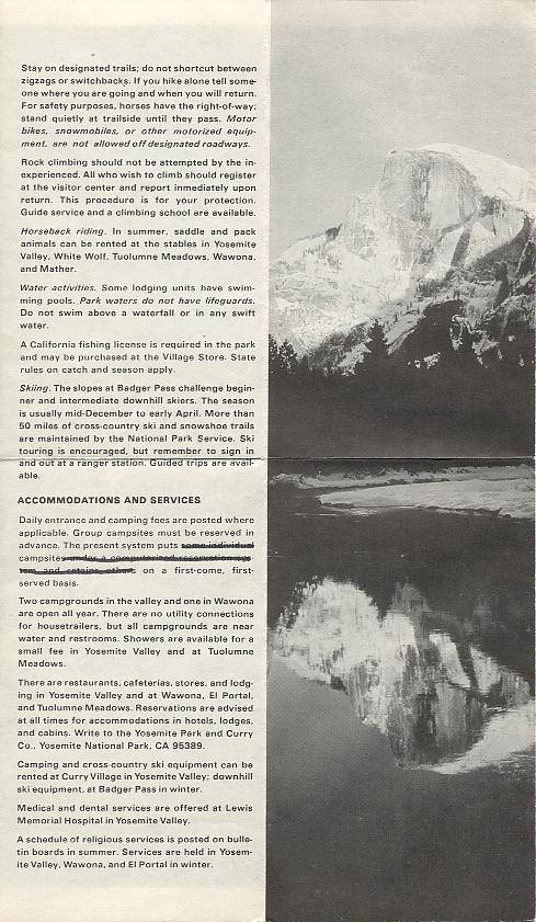 | 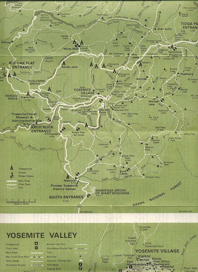 |
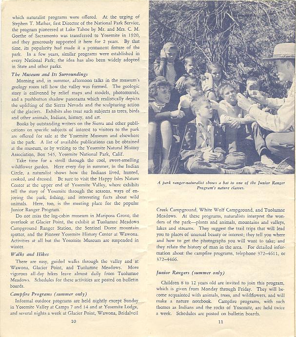
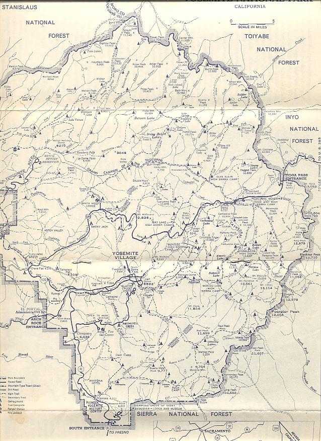
The folded pamphlet is titled Yosemite National Park, California and has a large and a small map on one side and text and a photo on the other side. It was published in 1974 by the National Park Service. The map scan shows only a portion of the maps. This was the pamphlet given to visitors when they entered the park.
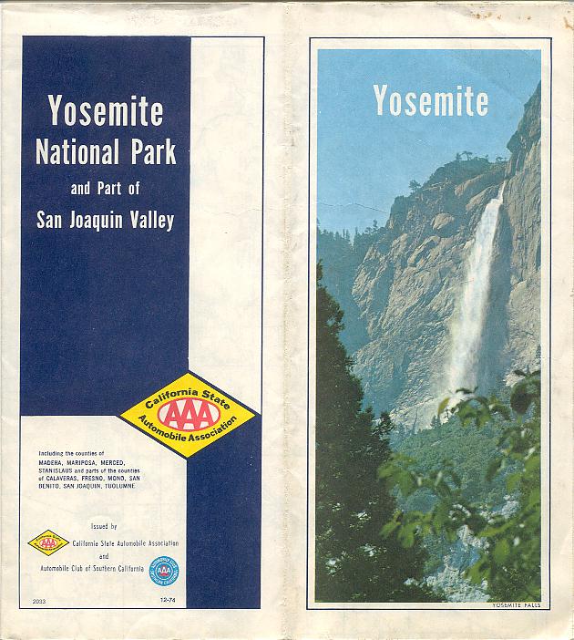 | 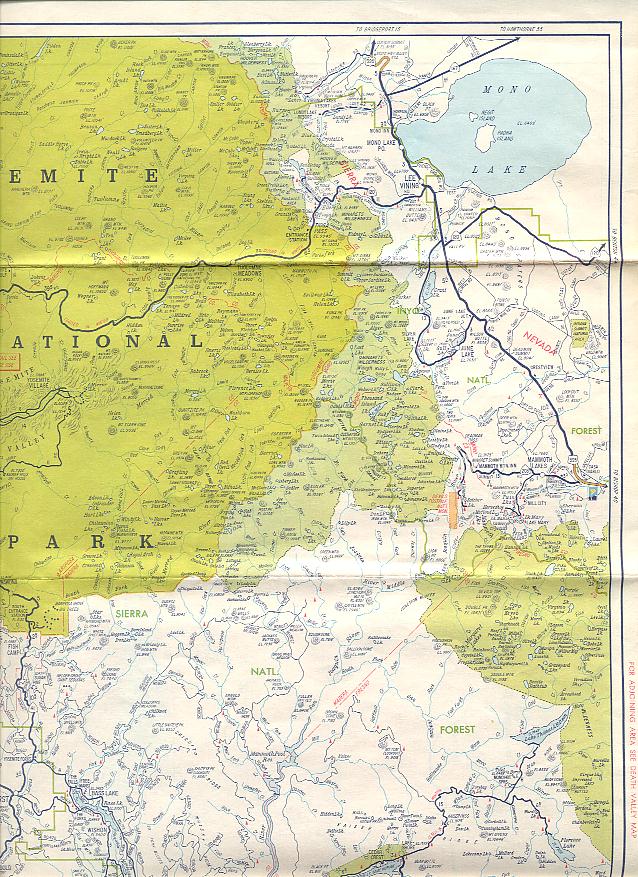 |  |
This folded map is titled Yosemite National Park and Part of San Joaquin Valley and has a large map on one side and two smaller maps on the other side. Completely unfolded it measures 28 x 20 1/8 inches. It was published in 1974 by the California State Automobile Association. The map scans show only a portion of the maps.
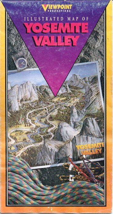 | 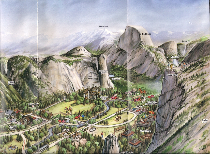 |
This folded map is titled Illustrated Map of Yosemite Valley and is a large folded sheet with a large colorful pictorial map on one side and text and small maps on the other side. Unfolded it measures 18 x 23 3/4 inches; and it folds into 10 panels or pages. It was published in 1990 by Viewpoint Productions, Fresno, CA. The map scan shows only a portion of the map.

![]() Return to first page
Return to first page